
2/1/2016: With the folk I usually walk with missing in inaction, I thought I’d try out a route I couldn’t convince anyone to do – Lugnaquilla (925m) from the south (Aughavannagh), taking in the ridges surrounding the Ow river valley. My planned route was about 18km with around 1,000m of ascent, so I started walking along the forest road in light drizzle not long after sunrise. There would only be about 7.5 hours until sunset (Ireland is 53 degrees north). It was quite mild with no wind so I didn’t bother with anything over or under my shorts. I would follow the river up the valley before crossing it and cutting up onto Aughavannagh mountain. Since there’d been so much rain over the last weeks the Ow was very full and it was apparent from the beginning that I’d have to cross quite a bit higher than planned.

Looks so peaceful when still…
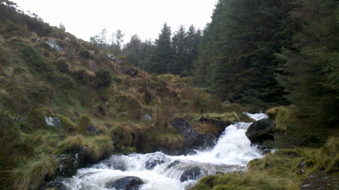
My river crossing experience was largely gained while living in New Zealand. I’ve crossed many that I’d consider difficult, walked up or down in some as natural “tracks” and stayed put for an extra night where they’ve been too dangerous to cross. The Ow didn’t look terribly difficult in width and depth but the rate of flow wasn’t to be messed with. I picked my way up the river’s sodden left bank. This lead to what looked like impenetrable managed pine forest, but fortunately the trees were spaced out quite a bit. Having once spent about an hour travelling 400m on my belly and getting grazed and cut all over by pine branches this was a good thing – it’s practically madness to plan to bash through these forests. After the woodland jaunt the bank steepened beyond what I’d climb into or out of. Still, there were nice things to look at while I wondered whether I’d have to walk back to the car and try another approach.

Water going down
Fortunately, above the waterfall the valley opened up again, leaving just myself and the river.

I’m pretty, but pretty unreasonable.
At least now I knew that at the very worst I’d be able to get around the river by climbing straight up the mountain. I kept my swift pace up, looking out for a place to cross while marvelling at this place I’d never visited before.

Mountains, river, rainbow… knees and toes, knees and toes!
It’s certainly the most adventurous approach to Lug I’ve tried and I already considered it among the best walks I’d done in the Wicklow mountains. Just when I’d think straightforwardness was ahead something unexpected would rear its head. The tributaries feeding the river weren’t safe to cross either so I ended up getting dragged further and further to the east of the valley. This added unnecessary ascent. The much smaller tributaries were also raging so there was no way I was putting a foot into one of them. They’d be crossed when I could easily step over them… or I’d keep climbing!
Wider than it looked – onwards and upwards!
When I finally crossed the major tributary it was pretty much at the top of the valley. It was fed by water sheeting straight off the mountain, feeding into its South Prison (effectively a cliff). These mountains are covered in blanket bog – something that can absorb a lot of water like a sponge, store it and release it slowly. High rainfall over the last month meant it was so saturated that water was now running straight off it instead.

The end of the line.
Once I’d stepped over that tributary I cut straight across the valley, down to the Ow and jumped straight over the blasted channel. “Take that, you bastard!”, I uttered loudly. It wasn’t the first time I’d sworn at the river but the only possible eavesdroppers were the odd deer.
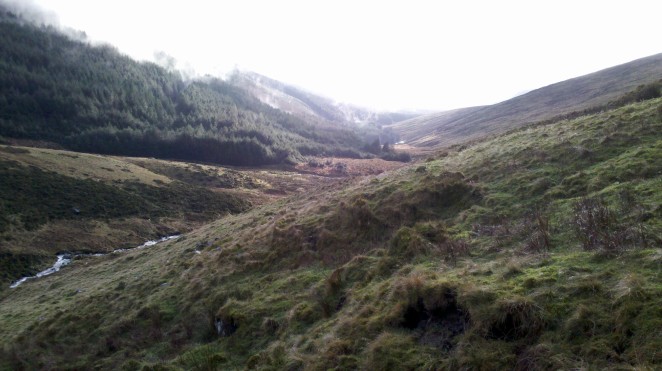
Looking down the Ow valley.
It was a quiet, lonely place, all the more beautiful for the threat of injury or death. There can be a terrific beauty in things that aren’t necessarily good for us and nature has plenty of these. Perhaps that’s why she can so easily capture a man’s heart – by treating him mean. Unlike a woman, who should be obeyed no questions asked, nature is something that’s just there. There to be respected, but like that river, nature needs to be shown who’s boss when hazardous. A couple of deer bounded down the valley bringing news of defeat. I punched the river and it exploded, before falling subjugated at man’s feet (cue gorilla sound effects).
The steep climb up to Lybagh had a little chuckle as it brought me back to reality, but it didn’t last long. As I made for Slievemaan the hills were coy but every now and then some flesh would be revealed.
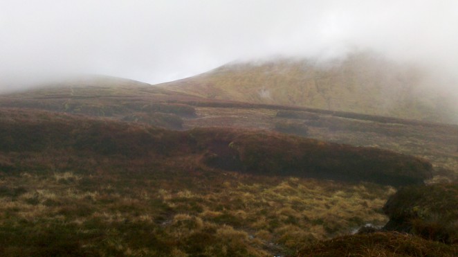
Lug shrouded in cloud
The rain had stopped quite a while ago – about 4km in as I left the forest. That was a quick stroll up a forest road, but the going was so slow after that that I’d been going for two hours before I got to the undistinguished top of Slievemaan.
Not worth it
It almost seemed like there was a vehicle track along the ridge but it skipped Maan and hit straight for the col between it and Lug. It’s the watershed feeding both the Ow and Little Slaney rivers… and there’s plenty of water up there. I picked my way carefully across soggy stretches to peat hags and other islands.

The Maan – Lug col
Next up was the steep climb up to Percy’s Table, where you’re practically at the top. I hadn’t eaten or drank since finishing the drive so I stopped for a piece of the Christmas porter cake I’d made and some water. Since I had them with me, I used walking poles to march up the slope. Poles are my favoured first aid kit – being things that can come in very handy to get you to somewhere an injury can be properly treated. I was now in shorts and a t-shirt – it really wasn’t cold and there was no breeze. As I broached Percy’s Table, I saw some other people for the first time. One of them seemed reasonably quick but he was waiting for a couple of stragglers.
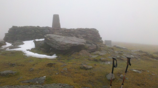
The view atop Lug: your hand in front of your face!
As usual, the very top is a great place to study the inside of various cloud formations (they all look the same). A welcome sandwich and the last of the cake was had while chatting to a couple of very friendly lads about walking and mountain biking. Like the other group, they’d come up from the Glen of Imaal, along the edge of the artillery range. Simple pleasures like some conversation and having that extra slice of peppered roast beef in your sandwich are all the more appreciated when they’re a rarity. Water tastes amazing when you’re thirsty, as does food when you’re hungry. For once I was both of these. At a slower pace I could walk all day without bothering about either.
The break was only twenty-five minutes. There was no real wind and it was warm enough on top so I hadn’t put anything over my shorts. Next move was towards the Corrigasleggaun ridge. The sodden, sickly-thin grass surface was slick and walking wasn’t that similar to doing so on an ice rink. It was very easy for a foot to slip out from under you on the flat, though.
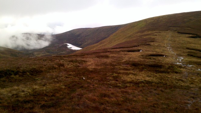
Kelly’s Lough and Corigasleggaun
There was another brief break in cloud cover for the approach to Corigasleggaun. Descending, it was important to hang a right at a featureless spot. This was over rougher, grassy bog with zero evidence that walkers had been this way. It seemed pretty aimless following a bearing towards cloud until it blew away and I could see the top of the forest I’d started in again. Then, I happened upon a very Irish thing: a fence in the middle of nowhere, seemingly serving little purpose other than to demark someone’s fairly useless land.

The forest, again
Crossing yet another dip in the bog I was surprised to stumble upon an old forest road that wasn’t on any map. Along its length were posts but no fence. Posts that were so badly rotten that perhaps the road had been abandoned for twenty years or more. The old track was crossed in many places by pools of sludgy bog that selfishly wouldn’t release their water into surrounding streams. Thus, the going was slow enough in places, but much quicker than trying to push through thick forest. It was very thick here.

Abandoned, unmarked forest road
About 1.5km on, the track seemed to disappear. This was where my pre-prepared route suggested I should look for a way through to a forest road below to the south-west. This route to my right seemed to terminate prematurely so I kept going straight… until that also ended. I was surrounded by forest with no quick way out. Perhaps 600m on through the wall of trees was another forest track. I made for that. The going was now extremely slow. Where trees existed they often did so in the closest possible proximity to each other… and piles of tree fall were common. It was worth taking the time to look for the next pocket of space. I ended up doubling back a bit so I made an effort to contour over to where I thought that forest road would be.

Some of the thinner forest. Very wet and grimy.
When I got to the top of my forest road I decided it’d be worth looking for an easier way up to where I’d started. It was simple enough to find and it ended up being exactly where my route guessed such a thing might be – I hadn’t looked for it hard enough earlier. Next time will be much easier.
Dropping back down I was surprised to cross a very well maintained forest road that wasn’t on the Ordnance Survey map. Since it wasn’t even two o’clock I decided to follow it back up in case it wasn’t on any of the online open maps (it was…).

End of the road
By the circular end of the road I’d come across a couple of lesser roads winding up through harvested wasteland to the top of the ridge. Dropping down to this road would be another easy option for this walk. I continued to scout around the forest roads, red-lining them with the GPS. One last discovery was a clearing linking our new mystery road with another one 100m below.

I am a clearing.
Anyway, yeah, that was the walk. I really liked it. Didn’t even think much about how crap the new Star Wars film is until the very end when I was wandering around forest tracks for no particularly good reason, eating a ham and peppered roast beef sandwich for a very good one. Even if the sandwich was soggy it’d have been better. That’s The Force Awakens – familiar like a soggy sandwich, but there’s more than a little wrong with it. Total distance was 26km, with about 1,100m of ascent. Time taken was 6h17m, although Strava seems to think that moving time was only 5h19m. Here’s the map. My pre-planned route is in blue. The actual one I took is in black.

The map
Note that the old forest trail is pretty much exactly where I’d hoped there might be some way down to one. A bit lucky that there was a route there, but it was obviously going to have to be there or nowhere since it was so tantalisingly close to a marked forest track. The unnecessary bush bash and exploring bits were needless, of course, but a future walk could drop straight off the ridge to the tip of the exploring road as the forest on this part of the hillside has all been harvested. There’s also a track leading up from it.
The bush bashing and other forest exploring added an hour and a half. More difficult to calculate, but getting across the river may have added another half an hour. There seems to be a track from the other side of the road bridge that leads straight up onto the ridge. Tried that at the start until I came across a gate with a rather unfriendly private property sign. Seems a bit mean to protect 800m of private forest track in the middle of nowhere near no infrastructure so jealously. That’s Ireland and land ownership again. If it sounds incomprehensible read or watch the John B. Keane play The Field. There’s a decent film version, too.
